Vista de Lectura

Hay nuevos artículos disponibles. Pincha para refrescar la página.

Automated Weed Spraying Drone Needs No Human Intervention
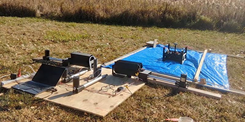
Battling weeds can be expensive, labor intensive and use large amounts of chemicals. To help make this easier [NathanBuilds] has developed  V2 of his open-source drone weed spraying system, complete with automated battery swaps, herbicide refills, and an AI vision system for weed identification.

The drone has a 3D printed frame, doubling as a chemical reservoir. V1 used a off-the-shelf frame, with separate tank. Surprisingly, it doesn’t look like [Nathan] had issues with leaks between the layer lines. For autonomous missions, it uses ArduPilot running on a PixHawk, coupled with RTK GPS for cm-level accuracy and a LiDAR altimeter. [Nathan] demonstrated the system in a field where he is trying to eradicate invasive blackberry bushes while minimizing the effect on the native prairie grass. He uses a custom image classification model running on a Raspberry Pi Zero, which only switches on the sprayers when it sees blackberry bushes in the frame. The Raspberry Pi Global Shutter camera is used to get blur-free images.

At just 305×305 mm (1×1 ft), the drone has limited herbicide capacity, and we expect the flights to be fairly short. For the automated pit stops, the drone lands on a 6×8 ft pad, where a motorized capture system pulls the drone into the reload bay. Here a linear actuator pushes a new battery into the side of the drone while pushing the spend battery one out the other side. The battery unit is a normal LiPo battery in 3D-printed frame. The terminal are connected to copper wire and tape contacts on the outside the battery unit, which connect to matching contacts in the drone and charging receptacles. This means the battery can easily short if it touches a metal surface, but a minor redesign could solve this quickly. There are revolving receptacles on either side of the reload bay, which immediately start charging the battery when ejected from the drone.

Developing a fully integrated system like this is no small task, and it shows a lot of potential. It might look a little rough around the edges, but [Nathan] has released all the design files and detailed video tutorials for all the subsystems, so it’s ready for refinement.
Amazon Receives FAA Approval for MK30 Delivery Drone

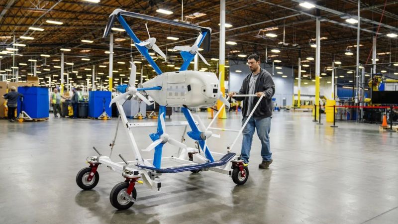
It’s been about a decade since Amazon began to fly its delivery drones, aiming to revolutionize the online shopping experience with rapid delivery of certain items. Most recently Amazon got permission from the FAA to not only start flying from its new Arizona-based location, but also to fly beyond-line-of-sight (BLOS) missions with the new MK30 drone. We reported on this new MK30 drone which was introduced earlier this year along with the news of the Amazon Prime Air delivery service ceasing operations in California and moving them to Arizona instead.

This new drone has got twice the range as the old MK27 drone that it replaces and is said to be significantly quieter as well. The BLOS permission means that the delivery drones can service areas which are not directly visible from the warehouse with its attached drone delivery facility. With some people within the service range of the MK27 drones having previously complained about the noise levels, we will see quickly enough whether the MK30 can appease most.

As for the type of parcels you can have delivered with this service, it is limited to 2.27 kg (~5 lbs), which is plenty for medication and a range of other items where rapid delivery would be desirable.

Custom Drone Software Searches, Rescues

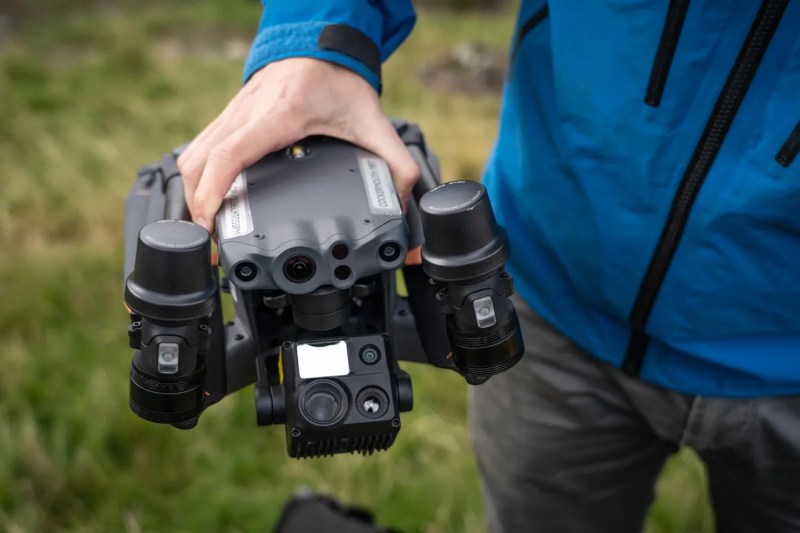
When a new technology first arrives in people’s hands, it often takes a bit of time before the full capabilities of that technology are realized. In much the same way that many early Internet users simply used it to replace snail mail, or early smartphones were used as more convenient methods for messaging and calling than their flip-phone cousins, autonomous drones also took a little bit of time before their capabilities became fully realized. While some initially used them as a drop-in replacement for things like aerial photography, a group of mountain rescue volunteers in the United Kingdom realized that they could be put to work in more efficient ways suited to their unique abilities and have been behind a bit of a revolution in the search-and-rescue community.

The first search-and-rescue groups using drones to help in their efforts generally used them to search in the same way a helicopter would have been used in the past, only with less expense. But the effort involved is still the same; a human still needed to do the searching themselves. The group in the UK devised an improved system to take the human effort out of the equation by sending a drone to fly autonomously over piece of mountainous terrain and take images of the ground in such a way that any one thing would be present in many individual images. From there, the drone would fly back to its base station where an operator could download the images and run them through a computer program which would analyse the images and look for outliers in the colors of the individual pixels. Generally, humans tend to stand out against their backgrounds in ways that computers are good at spotting while humans themselves might not notice at all, and in the group’s first efforts to locate a missing person they were able to locate them almost immediately using this technology.

Although the system is built on a mapping system somewhat unique to the UK, the group has not attempted to commercialize the system. MR Maps, the software underpinning this new feature, has been free to use for anyone who wants to use it. And for those just starting out in this field, it’s also worth pointing out that location services offered by modern technologies in rugged terrain like this can often be misleading, and won’t be as straightforward of a solution to the problem as one might think.

❌